
Maps
Plat maps are some of the best resources for local history research, genealogical research, house history research, and beyond. Delhi Township's original boundaries were Jolly Road at the north, Nichols Road at the south, Waverly Road at the west, and College Road at the east. Though the approximately northern third of Delhi Township was annexed by the City of Lansing in the early 1960s, the Holt-Delhi Historical Society still covers the history of Delhi Township as it originally existed - all the way to Jolly Road. Learn more about the Delhi-Lansing annexations. Some of our most prominent pioneers were residents of the northern parts of the Township, like the Norths, Everetts, Hilliards, and more, and omitting them from our history would render it incomplete.
Click on each map below to download PDF files of the map for you to explore. A few (1874, 1914, 1939, and 1967) link to HistoricMapWorks.com, an excellent online map database which allows for interactive exploration and even overlaying the historic map onto modern maps of the area.

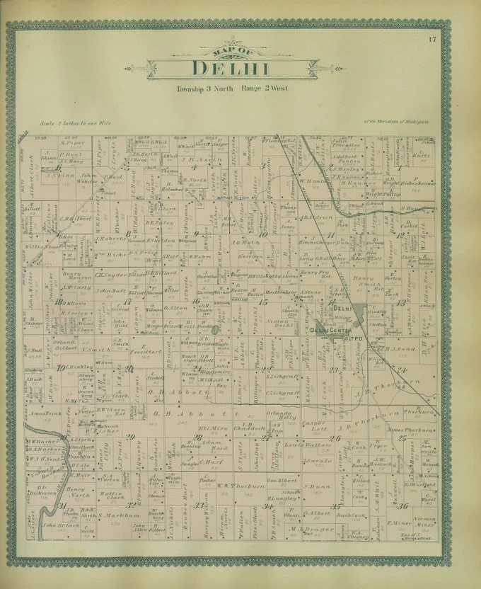
Delhi Township, 1859

Delhi Township, 1874

Delhi Center & Delhi Station, 1874
Delhi Township, 1895

Delhi Center/Holt, 1895

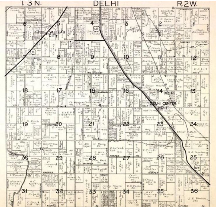
Delhi Township, 1914

Holt, c. 1923
Delhi Township, c. 1939

Delhi Township, 1943
Delhi Township, 1952

Delhi Township, c. 1958

Delhi Township, 1961
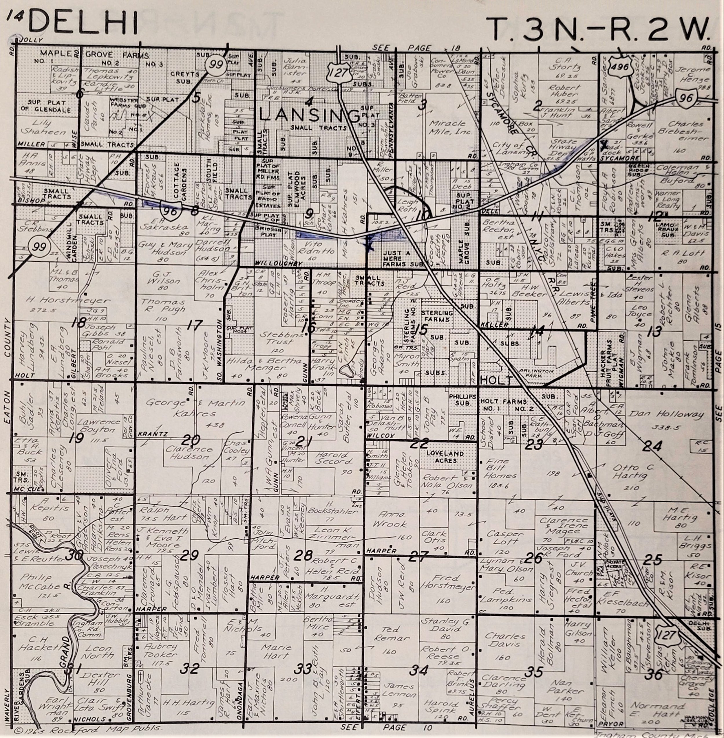
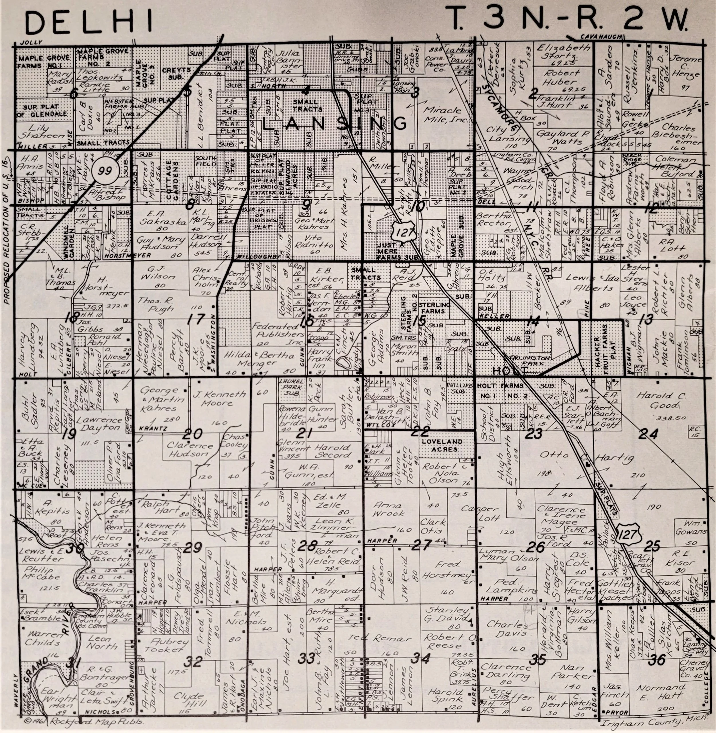
Delhi Township, 1963

Delhi Township, 1967

Delhi Township, 1970

Delhi Township, 1980

Delhi Township, 1995

Delhi Township GIS

Ingham and Livingston Counties, 1859